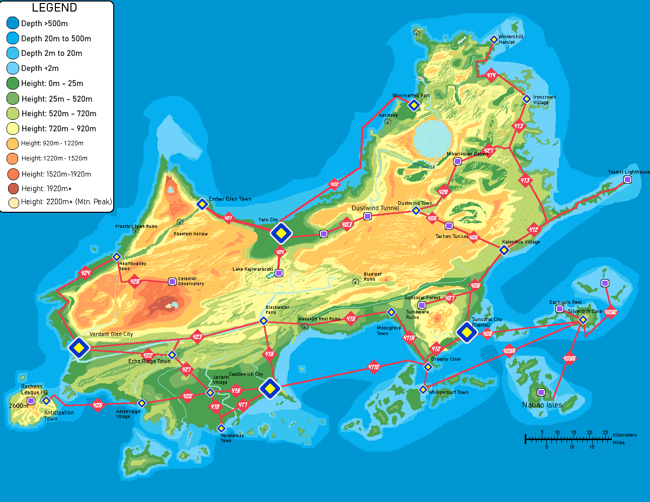
File:Rachenn-heightRoutesCities.png
Jump to navigation
Jump to search
Size of this preview: 776 × 599 pixels. Other resolutions: 311 × 240 pixels | 622 × 480 pixels | 994 × 768 pixels | 1,292 × 998 pixels.
Original file (1,292 × 998 pixels, file size: 191 KB, MIME type: image/png)
Summary
Made by me.
File history
Click on a date/time to view the file as it appeared at that time.
| Date/Time | Thumbnail | Dimensions | User | Comment | |
|---|---|---|---|---|---|
| current | 13:18, 24 November 2025 | | 1,292 × 998 (191 KB) | TShinjitsu (talk | contribs) | missing label |
| 13:00, 24 November 2025 |  | 1,292 × 998 (191 KB) | TShinjitsu (talk | contribs) | route changes | |
| 01:42, 21 November 2025 | 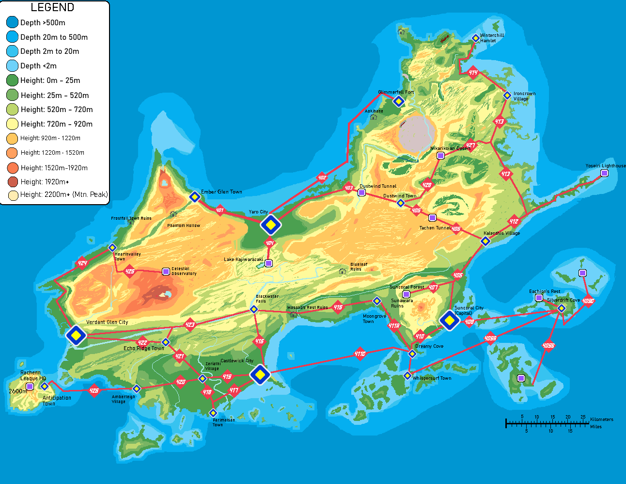 | 1,292 × 998 (191 KB) | TShinjitsu (talk | contribs) | POI label added | |
| 18:54, 20 November 2025 |  | 1,292 × 998 (190 KB) | TShinjitsu (talk | contribs) | Made by me. |
You cannot overwrite this file.
File usage
The following page uses this file: